Gilgit · Valleys
Naltar Valley
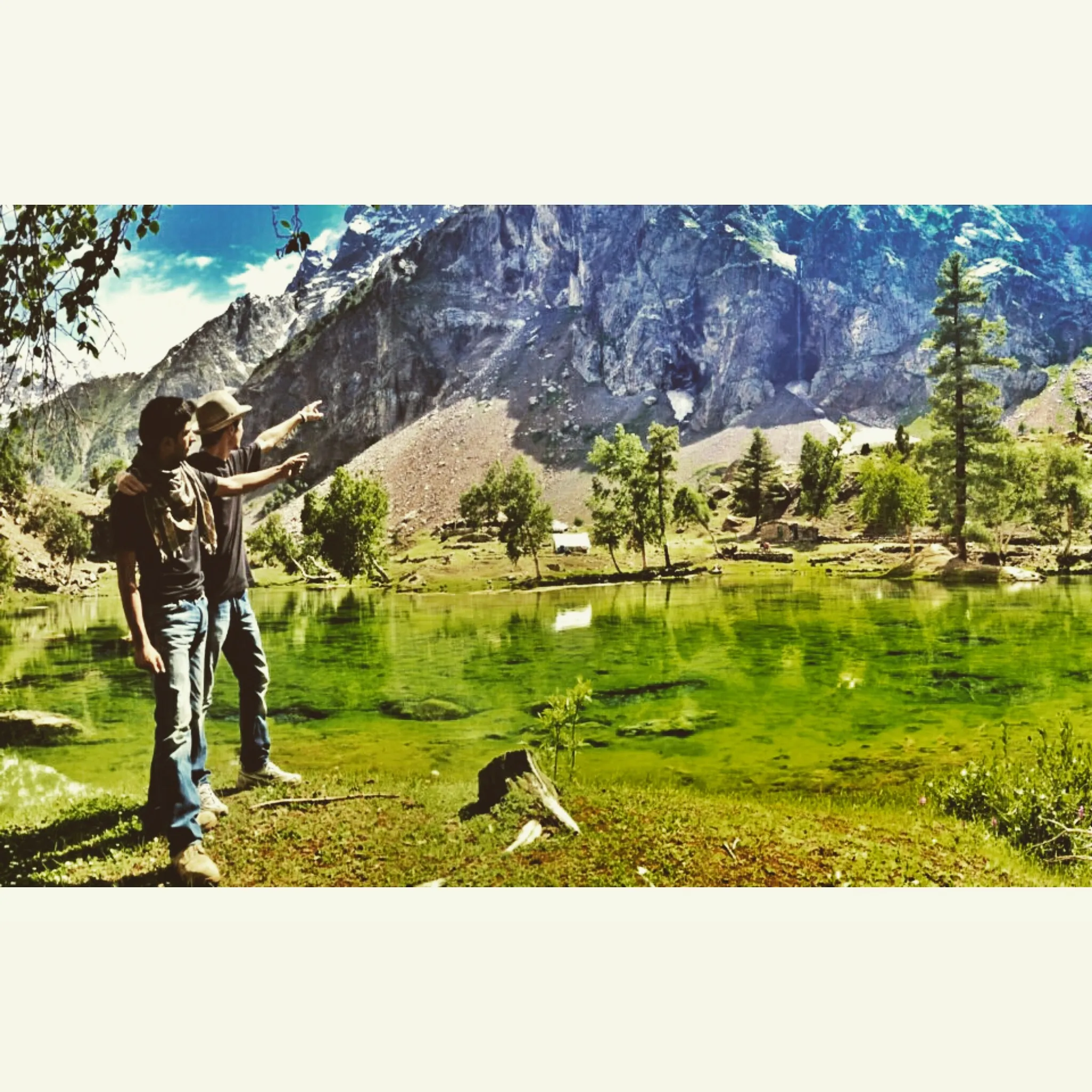
Naltar Valley is a Gilgit side valley known for alpine lakes, forested slopes, and a winter ski reputation. The final approach from Nomal is a rough jeep road, so most visitors treat it as an overnight or dedicated day trip from Gilgit.
Plan this tripAlso known as Naltar
Practical notes
- Facilities
- Limited lodging relative to Hunza; ski infrastructure in winter seasons when operating.
These notes are not a safety guarantee. Conditions change; check closer to your dates.
Conditions to reconfirm
Status may be outdated · Reconfirm before departure
Islamabad–Gilgit flights cancel often in poor weather. Treat a flight as a hope, not a schedule, and keep a road backup.
Access
Getting there
600 km
Distance
~16 hrs
Drive
Last mile
Rough jeep track from Nomal junction into Naltar (~35 km cited in guides).
Road Last stretch is rough; 4WD strongly recommended.
When to go
Month-by-month access and crowding.
- Ideal
- Crowded
- Risky
- Closed
- Unknown
Naltar Valley is a Gilgit side valley known for alpine lakes, forested slopes, and a winter ski reputation. The final approach from Nomal is a rough jeep road, so most visitors treat it as an overnight or dedicated day trip from Gilgit.
Flagship stops
Must-Visit Places in Naltar Valley
The places most travelers should prioritize here: viewpoints, lakes, forts, and trailheads that define a first visit. 6 with a full Sublime Northern guide.
- Open
Hunza Valley
I'd call Hunza the Karakoram's friendliest balcony: Karimabad terraces, Baltit and Altit forts, and peaks that look faintly offended by how photogenic they are. You'll base in Central Hunza for a few days and day-trip to Attabad, Passu, and the Hussaini bridge when the light behaves.
- Open
Karakoram Highway
The Karakoram Highway is the overland spine of northern Pakistan - Islamabad to Khunjerab through gorges, valleys, and high desert.
- Open
Naltar Lakes
Naltar Lakes is a lake near Naltar in northern Pakistan. This guide focuses on how to get there, when conditions are workable, and what to confirm on the ground before you go.
- Open
Bireno Suspension Bridge
A local suspension crossing near Gilgit listed by the provincial tourism site. Confirm access and whether it is open to visitors.
- Open
Chinese Cemetery
A Gilgit town heritage stop listed by provincial tourism. Treat it as a respectful cemetery visit, not a photo set.
- Open
Junction of Three Mountain Ranges
A named Gilgit-area viewpoint for the Karakoram, Himalaya, and Hindu Kush meeting - a short stop when you can find the signed or locally known place.
On the ground
What to expect
Facilities
Basic
Permit
Not required
Entry fee
Confirm locally
Facilities Limited lodging relative to Hunza; ski infrastructure in winter seasons when operating.
The story
Reached via the Nomal junction west of Gilgit, Naltar feels more enclosed and alpine than the main KKH towns. Summer visitors come for lakes and colour; winter draws ski travelers when conditions and operations allow. Because the last stretch needs high clearance, plan jeep hire and daylight hours. Combine with Hunza only if you budget transfer time through Gilgit - it is nearby on the map but not a quick detour from Karimabad.
Photos
3 photos
On the map
Naltar Valley
Approximate coordinates — confirm the trailhead locally: 36.13000, 74.18000 · Open in OpenStreetMap
Sleep
Where to stay
Base yourself in
- Gilgit
Typical night
PKR 3,000-10,000 / night
- Guesthouses
- Homestays
- Camping / tents
Book vs walk-in Peak Jul-Aug fills the better rooms first. Outside that, I'd call a day ahead rather than trust walk-in miracles.
Limited lodging relative to Hunza; ski infrastructure in winter seasons when operating.
Luggage
What to pack
Here's what I'd actually put in the bag for Naltar Valley - not a catalog fantasy, just the kit that stops the trip from becoming a negotiation with the weather.
Essential
- Soft duffel or roller + daypack40-50L soft bag + 20-30L daypack
Soft bags survive jeep roofs better than hard shells. Keep the daypack for hikes and last-mile walks.
- Layered clothingBase + mid + shell
Mornings can bite even when afternoons feel gentle. I'd rather peel layers than freeze on a viewpoint.
- Rain / wind shell1
Mountain weather invents hobbies. A light shell earns its keep.
- Cash (PKR)3-5 days float
ATMs are uneven. I'd rather carry a boring wad than negotiate with a machine that has opinions.
- Sun protectionHat + SPF + sunglasses
Altitude sun is cheerful and unkind.
- Basic first-aid + personal medsSmall kit
Blister care, pain relief, any prescriptions you actually need.
- Warm sleep / evening layer1 insulated jacket or fleece
Even in summer, evenings above 2,500 m remind you that physics is real.
- Trail shoes or broken-in boots1 pair + sandals for evenings
New boots on day one is how legends (and blisters) are born.
Nice to have
- Power bank1
Outages and long jeep days love dead phones.
- Reusable water bottle1L+
Refill where water is trusted; carry more on jeep lake days.
- Altitude pacing planBuffer day if flying in high
I'd keep the first day gentle if I just arrived from the plains.
Money
Rough costs
Per person / day
PKR 5,000-14,000
Stay + simple meals + local hops
Rough ballpark per person for stay, simple meals, and local hops - not a private jeep every day. Jeep lake / glacier days spike costs; peak Jul-Aug leans high. Confirm fares locally; my numbers go stale faster than apricot jam.
Nearby
Easy add-ons while you’re around Naltar Valley.
1 place
Trip reports
No trip reports yet. Be the first to share one.
How this guide was checked
This guide was desk researched and has not yet been field verified.
Current road, permit, and weather status: confirm locally. Conditions change.
No named field editor is attached to this page yet — we do not invent bylines.