Azad Kashmir · Meadows
Arang Kel
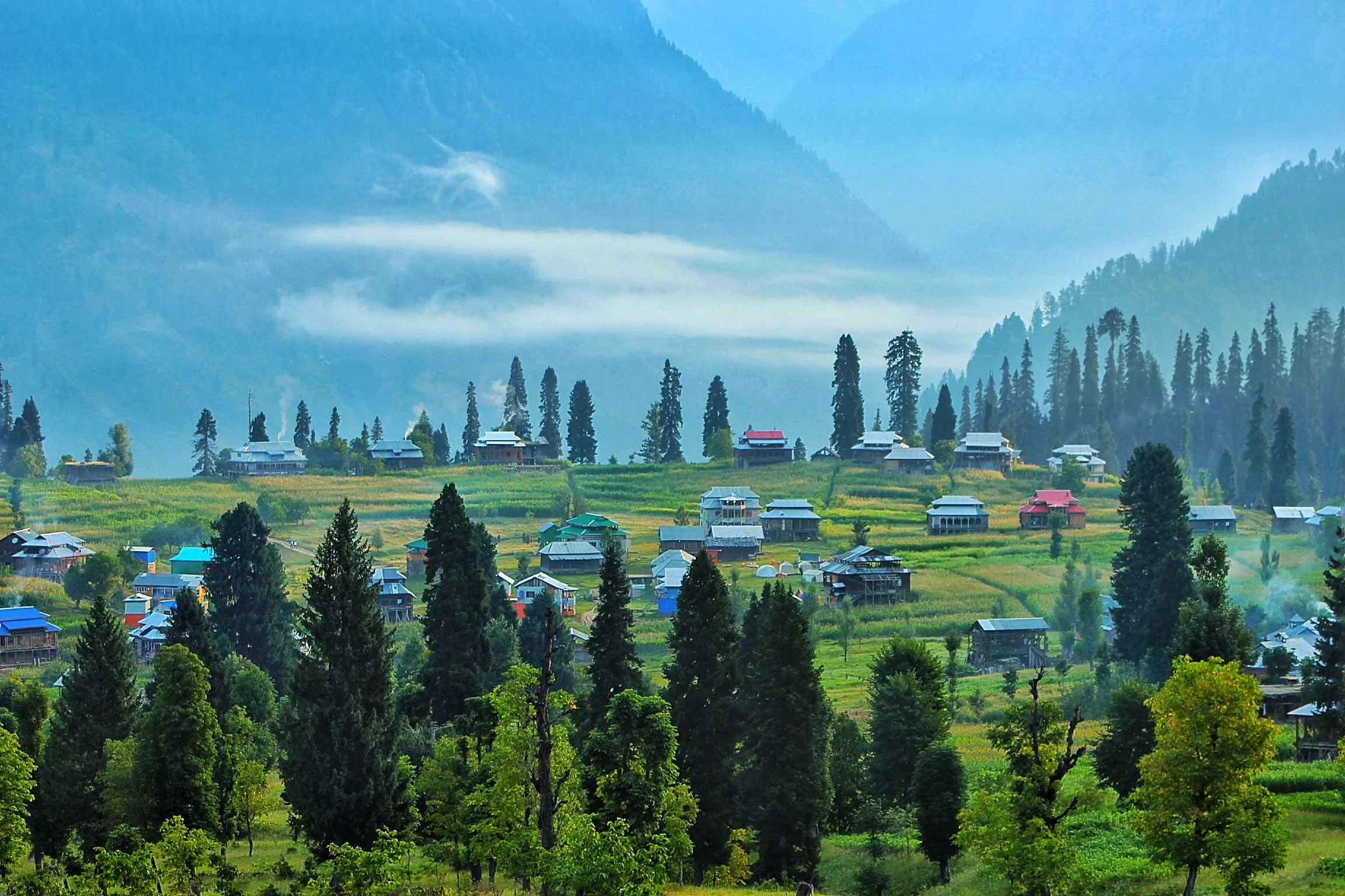
Arang Kel is a meadow village above Kel in Neelum Valley, typically reached by jeep and a short steep walk. Overnight stays are common so travelers can enjoy morning views without rushing the long Neelum road in one push.
Plan this tripAlso known as Arangkel, Arang Khel
Practical notes
- Facilities
- Guesthouses and camping reported in season; services thinner outside peak months.
These notes are not a safety guarantee. Conditions change; check closer to your dates.
Access
Getting there
280 km
Distance
~10 hrs
Drive
Last mile
Jeep from Kel then steep walk / pony into Arang Kel.
Road Neelum Valley road then rough jeep track.
When to go
Month-by-month access and crowding.
- Ideal
- Crowded
- Risky
- Closed
- Unknown
Arang Kel is a meadow village above Kel in Neelum Valley, typically reached by jeep and a short steep walk. Overnight stays are common so travelers can enjoy morning views without rushing the long Neelum road in one push.
On the ground
What to expect
Facilities
Basic
Permit
Not required
Entry fee
Confirm locally
Facilities Guesthouses and camping reported in season; services thinner outside peak months.
Permit Confirm Azad Kashmir travel / photography rules along the Neelum corridor.
The story
The settlement sits on a green shelf above the Neelum River corridor and is one of Azad Kashmir’s better-known highland stops. Access is slower than Kaghan jeep meadows because of the long valley approach. Pair with a broader Neelum Valley itinerary rather than a same-day return from Islamabad. Confirm road status after monsoon rains and carry layers for cool evenings even in summer.
Photos
2 photos
On the map
Arang Kel
Approximate coordinates — confirm the trailhead locally: 34.81000, 74.35000 · Open in OpenStreetMap
Nearby
Easy add-ons while you’re around Arang Kel.
1 place
Trip reports
No trip reports yet. Be the first to share one.
How this guide was checked
Verified through official and published sources. Not a field visit.
Current road, permit, and weather status: confirm locally. Conditions change.
No named field editor is attached to this page yet — we do not invent bylines.